Trout Fishing at Shieldaig
Shieldaig is a picturesque Scottish village in Scotland, with a superb location on the shores of Loch Shieldaig, set against a backdrop of the magnificent mountains of Torridon, and Beinn Alligin and Liathach. Loch Shieldaig and the surrounding waters had been famed for their herring since the days of the Vikings, and the village’s prosperity was for many years based on the success of its fishing fleet. The village itself comprises a string of whitewashed cottages built on a raised beach along the shore of the loch with others scattered up the rising ground behind.

Shieldaig is yet another perfect location for the trout fisherman to explore the wild trout lochs of this remote part ofWester Ross. You may be the first angler to cast a fly on your chosen loch in years. Some of the many fine lochs include Loch Mhullaich, Loch Diabaigs Airde, Loch Fada, Loch na Caorach, Loch na Creige, Loch Gaineamhach, Loch Ceopach, Loch Lundie, Loch a Choire Bhuidhe, Loch Damh, Loch an Loin, Loch an Eoin, Loch Coultrie, Loch an Neimhe and Loch Coire Fionnaraich.
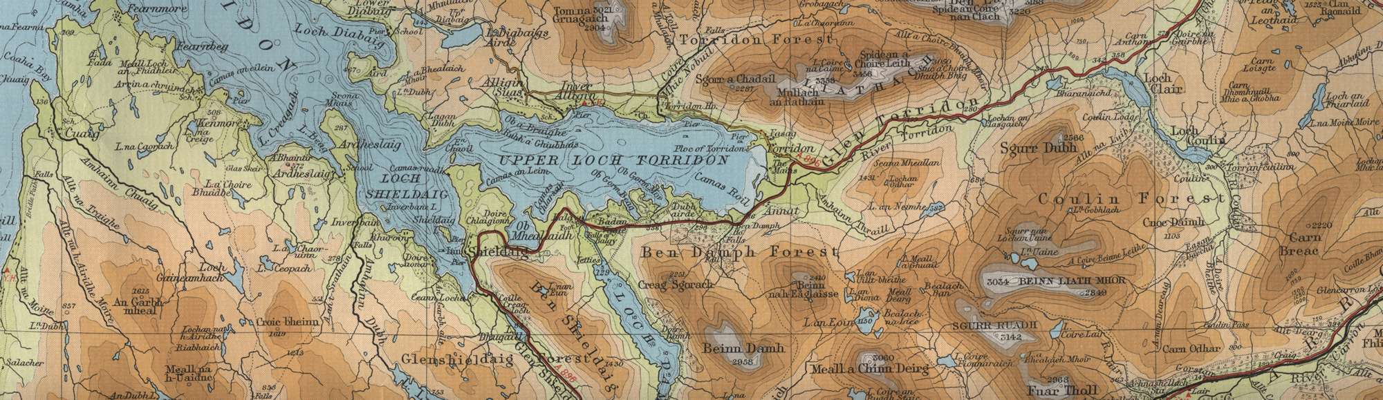
Shieldaig Trout Fishing Map
Tap or click on the map below to view full size image

The maps on this website, extracts from the “Half Inch” Bartholomew map series of the mid twentieth century, have been reproduced with the permission of Collins Bartholomew. Viewers should note that these maps date back several decades, to the mid twentieth century in fact. While much of the man-made details such as roads and buildings will have changed over the years, the character of the hills, lochs and rivers, and the trout inhabiting them, will have remained very much the same as they have always been, in the more remote regions at any rate! This website shows detailed maps of the major fishing locations. In addition, however, I would recommend that anglers planning a Scottish fishing or walking trip should be sure to equip themselves with a compass, the appropriate local Ordnance Survey map and a working knowledge of how to use them. The most useful of the O.S. maps for the fisherman is the Landranger series, scale 1:50,000. For Shieldaig, see O.S. map number 24.