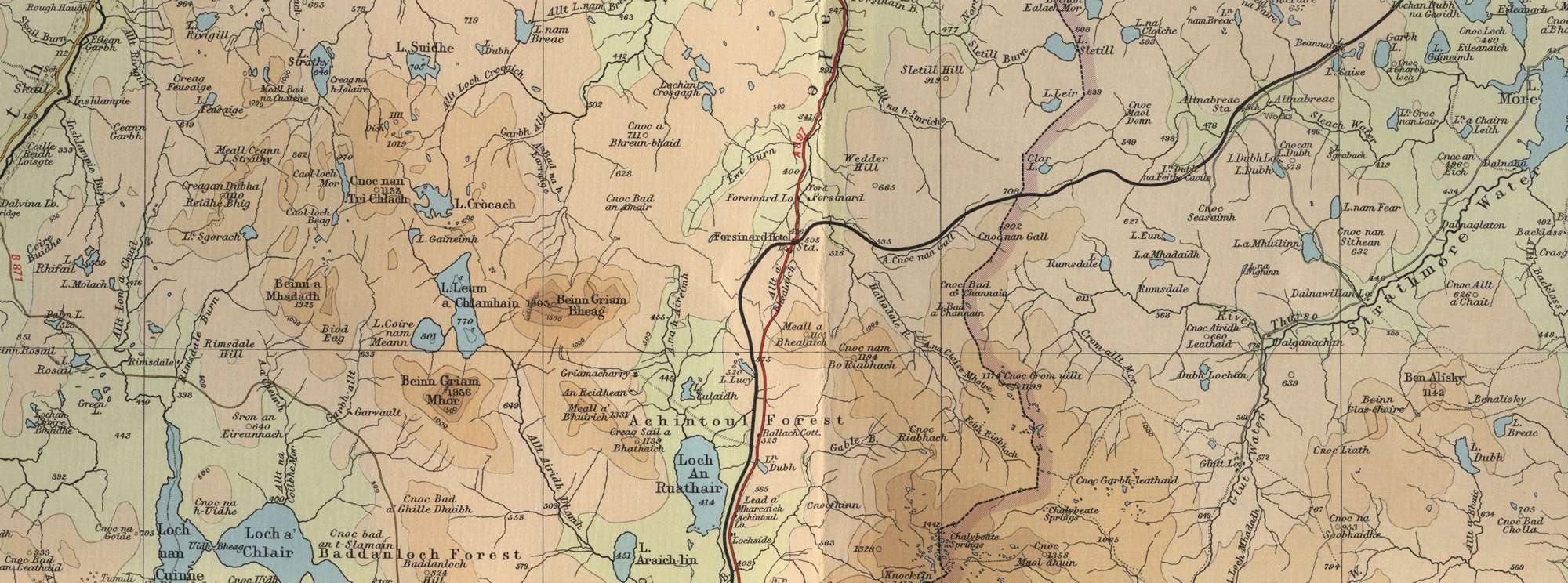
Trout Fishing Lochs near Forsinard
Forsinard is located in the Flow Country at the southern end of Strath Halladale on the A897 and on the North Highland Railway line. It lies within reach of a number of very good trout lochs, some easily accesssible from the road, others more remote and requiring some effort and a stiff hike to reach. The effort will be well worth it though, with some excellent trout fishing at the end of it in the splendid isolation of the Flow Country peat moors. Just a few of the lochs include Loch Crocach, Loch Leum a Chlamhain, Loch Coire nan Meann, Loch An Ruathair, Loch a Chlair, Loc Allt an Fhearna, Loch Rumsdale, Loch a Mhadaidh, Loch Sletill, Loch Strathy and Loch Araich-Lin.
A new fly fishing club formed recently to enhance the fishing opportunities available in the Strath Halladale area for the local community and visiting anglers. Membership is open to all and seasonal membership very reasonably priced. Fishing sessions must be booked on individual lochs online via the website, with 41 lochs available for members to bank fish. Boats are also available for members on 10 lochs with a minimal charge applying.
Forsinard Trout Fishing Map
Tap or click on the map below to view full size image

The maps on this website, extracts from the “Half Inch” Bartholomew map series of the mid twentieth century, have been reproduced with the permission of Collins Bartholomew. Viewers should note that these maps may date back several decades. While much of the man-made details such as roads and buildings will have changed over the years, the character of the hills, lochs and rivers, and the trout inhabiting them, will have remained very much the same as they have always been, in the more remote regions at any rate! This website shows detailed maps of the major fishing locations. In addition, however, I would recommend that anglers planning a Scottish fishing or walking trip should be sure to equip themselves with a compass, the appropriate local Ordnance Survey map and a working knowledge of how to use them. The most useful of the O.S. maps for the fisherman is the Landranger series, scale 1:50,000. For Forsinard, see O.S. map number 10.
For information on the salmon fishing rivers in the area see Salmon Fishing in Scotland