Trout Fishing Lochs in Glengarry
Invergarry village lies on the main route between Fort William and Inverness in the Great Glen, at the point where the River Garry enters Loch Oich, near the ruins of the 17th century Invergarry Castle. Around the village there are superb walks for all abilities and the surrounding area offers trout fishing on some of the larger highland lochs, set amid some grand mountains. Anglers come here to hunt the large ferox trout which inhabit the deep glacial lochs Cluanie, Garry, Loyne and Quoich but they also hold a good stock of more modest trout, which will often readily rise to a well presented fly.
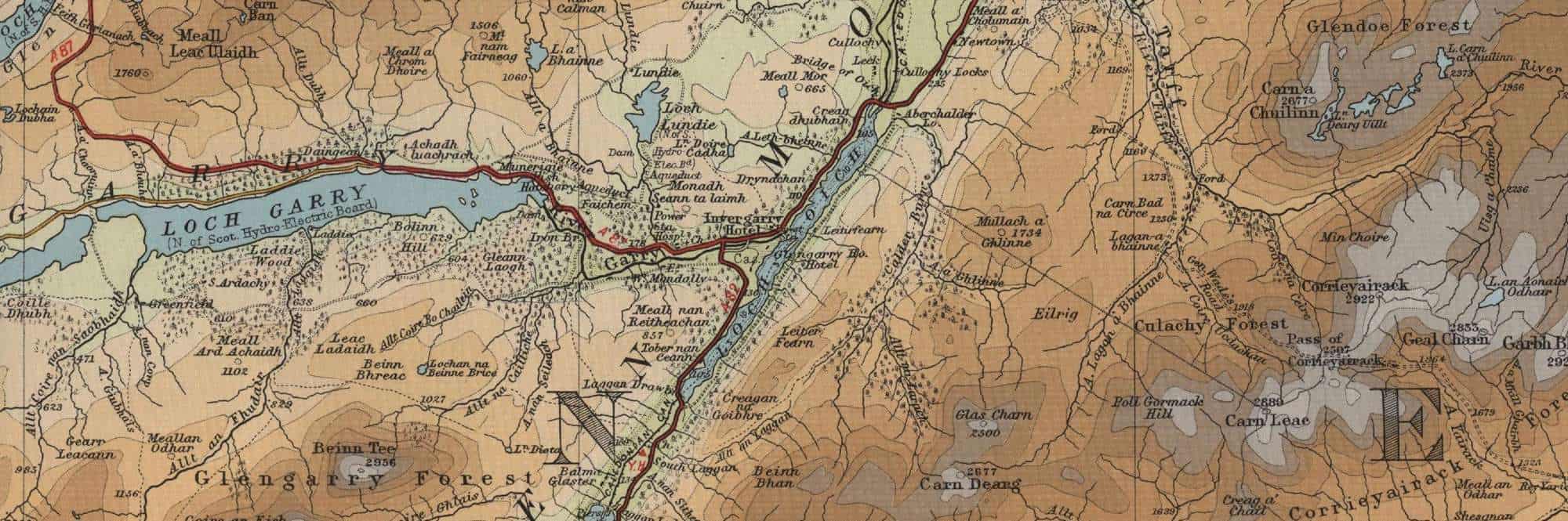
Glengarry Trout Fishing Map
Tap or click on the map below to view full size image

The maps on this website, extracts from the “Half Inch” Bartholomew map series of the mid twentieth century, have been reproduced with the permission of Collins Bartholomew. Viewers should note that these maps date back several decades, to the mid twentieth century in fact. While much of the man-made details such as roads and buildings will have changed over the years, the character of the hills, lochs and rivers, and the trout inhabiting them, will have remained very much the same as they have always been, in the more remote regions at any rate! This website shows detailed maps of the major fishing locations. In addition, however, I would recommend that anglers planning a Scottish fishing or walking trip should be sure to equip themselves with a compass, the appropriate local Ordnance Survey map and a working knowledge of how to use them. The most useful of the O.S. maps for the fisherman is the Landranger series, scale 1:50,000. For Glengarry, see O.S. map number 34.
For information on the salmon fishing rivers in the area see Salmon Fishing in Scotland