Trout Fishing at Scourie
Scourie, on the west Sutherland coast just to the south of the famous sea bird sanctuary of Handa Island, is a true trout fisherman’s paradise, well known to Scottish anglers as a superb centre for exploring the countless trout fishing lochs in the area. Hundreds of trout lochs dot the rugged landscape, some easily accessible, others requiring a fair bit of effort to reach on foot, all holding hard fishing wild Scottish brown trout. Much of the fishing is managed by the Scourie Hotel and available to guests staying at this historic fishing hotel.

In addition, readily accessible and reasonably priced trout permits are made available for 47 lochs leased from the Scourie Estate by the local Scourie and District Angling Club, a nonprofit making organisation set up to foster and promote hill loch fishing in the area and provide reasonable priced fishing for the local and visiting angler. The size of trout in them is variable but some – it is up to the angler to discover which ones – hold larger trout. Indeed, in most seasons fish of 2 to 4lbs in weight are regularly caught. The club also has boats for hire on a number of lochs. Lochs on the angling club permit include Loch Rhu Dhu, Loch Na Accrarsaid, Caol Loch, Loch Phol Dorch, Loch Lis, Loch Gobhloch, Loch Nam Brac, Loch na Creige, Loch ‘Mhice, Loch Laicheard ‘Mhor and Beg, Plantation Loch, Mackay’s Loch, Loch Phreasain Chaltuinne, Loch Druim Na Collie, Loch Bhadaidh Daraich, Loch An Damh Mor, Loch Chalbha and many more. Enough to keep even the most eenergetic and enthusiastic angler happily occupied for several lifetimes!
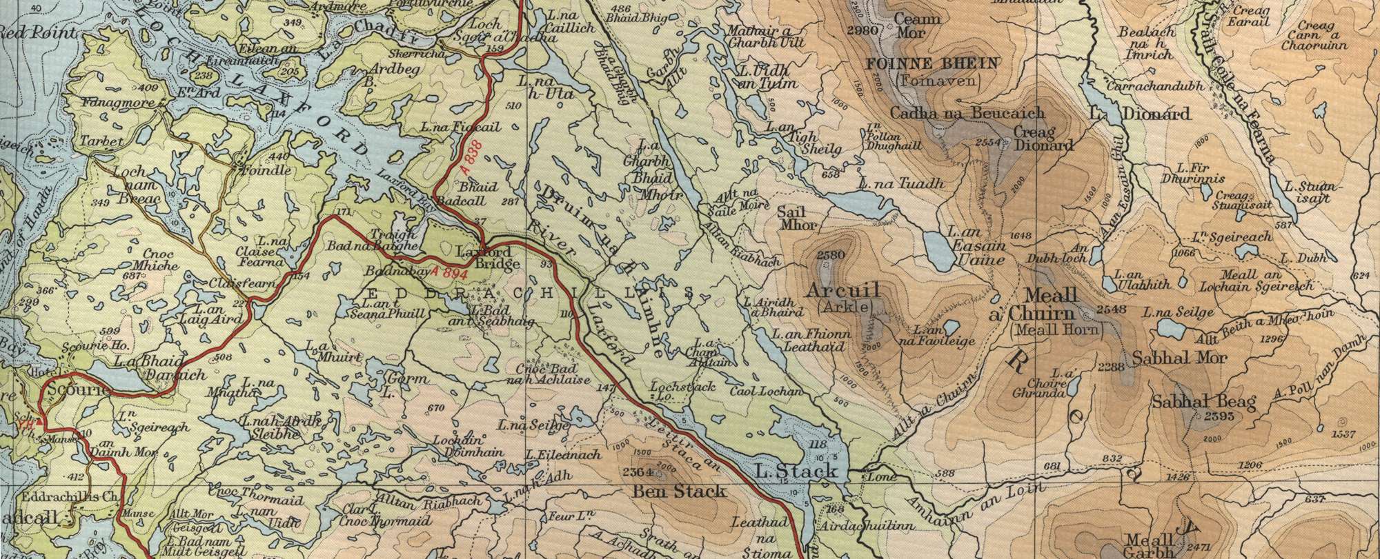
Scourie Trout Fishing Map
Tap or click on the map below to view full size image

The maps on this website, extracts from the “Half Inch” Bartholomew map series of the mid twentieth century, have been reproduced with the permission of Collins Bartholomew. Viewers should note that these maps date back several decades, to the mid twentieth century in fact. While much of the man-made details such as roads and buildings will have changed over the years, the character of the hills, lochs and rivers, and the trout inhabiting them, will have remained very much the same as they have always been, in the more remote regions at any rate! This website shows detailed maps of the major fishing locations. In addition, however, I would recommend that anglers planning a Scottish fishing or walking trip should be sure to equip themselves with a compass, the appropriate local Ordnance Survey map and a working knowledge of how to use them. The most useful of the O.S. maps for the fisherman is the Landranger series, scale 1:50,000. For Scourie, see O.S. map number 9.
For information on the salmon fishing rivers in the area see Salmon Fishing in Scotland