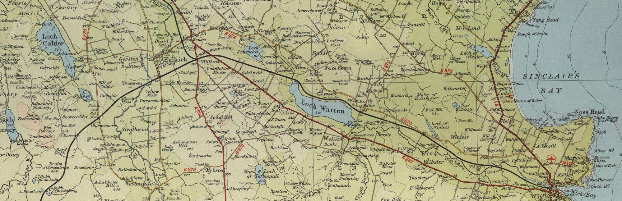
Trout Fishing Lochs near Halkirk
Halkirk is a town situated to the south of Thurso in northern Caithness, lying on the banks of the River Thurso, almost as far north as you can get on the Scottish mainland. It is surrounded by some excellent trout fishing lochs such as Calder, Heilen, Watten, Scarmclett, Toftingall and St John’s. It is an excellent centre from which the trout fisherman can explore the superb loch fishing of this part of north east Scotland, on the eastern edge of the Flow Country. Local angling clubs include Dounreay Fly Fishing Association and St John’s Loch Angling Improvement Association. Both offer permits to visiting anglers. Wild brown trout fly fishing at its very best!
Halkirk Trout Fishing Map
Tap or click on the map below to view full size image

The maps on this website, extracts from the “Half Inch” Bartholomew map series of the mid twentieth century, have been reproduced with the permission of Collins Bartholomew. Viewers should note that these maps date back several decades, to the mid twentieth century in fact. While much of the man-made details such as roads and buildings will have changed over the years, the character of the hills, lochs and rivers, and the trout inhabiting them, will have remained very much the same as they have always been, in the more remote regions at any rate! This website shows detailed maps of the major fishing locations. In addition, however, I would recommend that anglers planning a Scottish fishing or walking trip should be sure to equip themselves with a compass, the appropriate local Ordnance Survey map and a working knowledge of how to use them. The most useful of the O.S. maps for the fisherman is the Landranger series, scale 1:50,000. For Halkirk, see O.S. map number 12.
For information on the salmon fishing rivers in the area see Salmon Fishing in Scotland