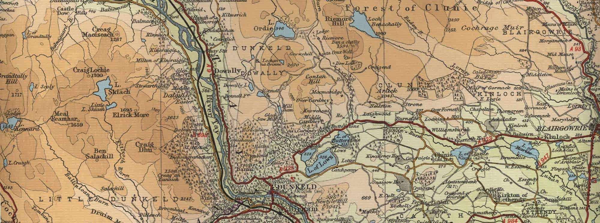
Trout Fishing Lochs around Dunkeld
The old cathedral town of Dunkeld sits on the banks of the mighty River Tay, just off the A9 between Perth and Pitlochry. Dunkeld makes a good centre for the trout fisherman, offering easy access to a number of trout Lochs in the vicinity, and river fishing, for both trout and salmon, on the Rivers Tay and its tributary the River Braan. Examples of local trout lochs are Loch of Lows, Butterstone Loch, Loch Kennard, Loch Skiach, Loch Freuchie, Loch of Markie, Loch of Clunie, Loch of Craiglush, Loch Ordie and Loch Benachally.
Dunkeld Trout Fishing Map
Tap or click on the map below to view full size image

The maps on this website, extracts from the “Half Inch” Bartholomew map series of the mid twentieth century, have been reproduced with the permission of Collins Bartholomew. Viewers should note that these maps date back several decades, to the mid twentieth century in fact. While much of the man-made details such as roads and buildings will have changed over the years, the character of the hills, lochs and rivers, and the trout inhabiting them, will have remained very much the same as they have always been, in the more remote regions at any rate! This website shows detailed maps of the major fishing locations. In addition, however, I would recommend that anglers planning a Scottish fishing or walking trip should be sure to equip themselves with a compass, the appropriate local Ordnance Survey map and a working knowledge of how to use them. The most useful of the O.S. maps for the fisherman is the Landranger series, scale 1:50,000. For Dunkeld, see O.S. map number 53.
For information on the salmon fishing rivers in the area see Salmon Fishing in Scotland