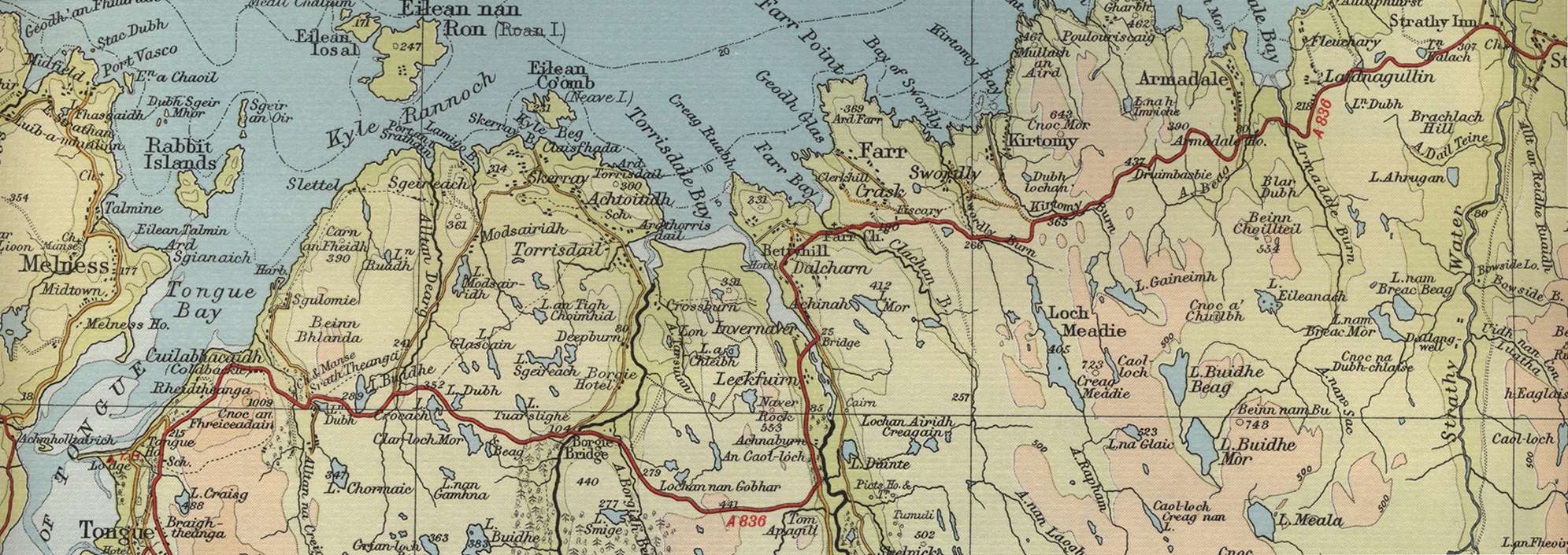
Trout Fishing Lochs near Bettyhill
Bettyhill lies at the mouth of the River Naver on the north Sutherland coast, ideally placed as a base from which to explore the numerous trout lochs to the west, east and south in and around Strath Naver. All the lochs in the area have the potential to provide fabulous fly fishing in the most magnificent setting for truly wild brown trout. A walk into the hills will take you to lochs and lochans which may not have seen a fisherman’s fly in years, perhaps decades.

Just a few of the countless lochs include, to the east and south east, Loch Meadie, Loch Gaineimh, Loch Buidhe Beag, Loch Buidhe Mor, Loch na Caorach Mor, Loch na Clach and to the west and south west, Loch na Cleibh, Loch Smige, Loch Sgeireach, Loch Modsairidh, Loch Buidhe and Loch nan Ealachan. The salmon fisherman, too, will find great fishing here in the Rivers Naver and Borgie.
Bettyhill Trout Fishing Map
Tap or click on the map below to view full size image

The maps on this website, extracts from the “Half Inch” Bartholomew map series of the mid twentieth century, have been reproduced with the permission of Collins Bartholomew. Viewers should note that these maps date back several decades, to the mid twentieth century in fact. While much of the man-made details such as roads and buildings will have changed over the years, the character of the hills, lochs and rivers, and the trout inhabiting them, will have remained very much the same as they have always been, in the more remote regions at any rate! This website shows detailed maps of the major fishing locations. In addition, however, I would recommend that anglers planning a Scottish fishing or walking trip should be sure to equip themselves with a compass, the appropriate local Ordnance Survey map and a working knowledge of how to use them. The most useful of the O.S. maps for the fisherman is the Landranger series, scale 1:50,000. For Bettyhill, see O.S. map number 10.
For information on the salmon fishing rivers in the area see Salmon Fishing in Scotland