Trout Fishing in the Pentland Hills
The Pentland Hills lie to the south of Edinburgh. Here are located a number trout fisheries, some on natural lochs. Others, established on water supply reservoirs, were formerly run as trout fisheries by East of Scotland Water but are now generally run independently as either club or commercial fisheries, most available to the public on day tickets. The major lochs include Cobbinshaw, Harper Rig, Gladhouse, Crosswood, Threipmuir, Glencorse, Loganlea, Portmore, West Water, Clubbiedean, Edgelaw and Rosebery.
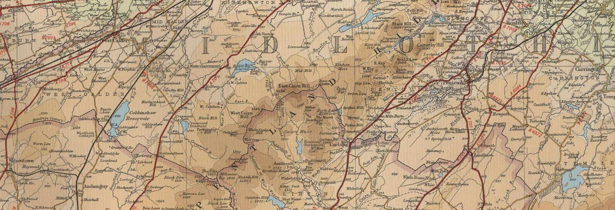
Pentland Hills Trout Fishing Map
Tap or click on the map below to view full size image

The maps on this website, extracts from the “Half Inch” Bartholomew map series of the mid twentieth century, have been reproduced with the permission of Collins Bartholomew. Viewers should note that these maps date back several decades, to the mid twentieth century in fact. While much of the man-made details such as roads and buildings will have changed over the years, the character of the hills, lochs and rivers, and the trout inhabiting them, will have remained very much the same as they have always been, in the more remote regions at any rate! This website shows detailed maps of the major fishing locations. In addition, however, I would recommend that anglers planning a Scottish fishing or walking trip should be sure to equip themselves with a compass, the appropriate local Ordnance Survey map and a working knowledge of how to use them. The most useful of the O.S. maps for the fisherman is the Landranger series, scale 1:50,000. For the Pentland Hills area, see O.S. map number 66.