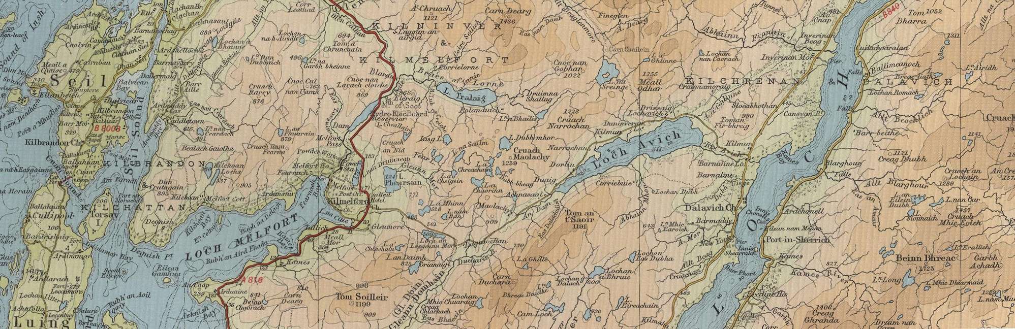
Trout Fishing near Kilmelford in Argyll
Kilmelford is a small coastal village situated 16 miles to the south of Oban on sea loch Loch Melfort. This is an area of outstanding natural beauty, ideally located for exploring the hills on foot, or the surrounding coast and islands by boat. The sheltered anchorage of Loch Melford makes the village a popular haven for boats sailing around Mull and the islands of the Inner Hebrides. While sea fishing in the area offers a great variety of species, the village makes an excellent trout fishing centre, with many hill lochs available, many managed by the Oban and Lorn Angling Club. This area was a favourite of Colonel Oatts and his experiences of the fishing in the local lochs formed much of the basis for his book on “Loch Trout”, published in 1958. Lochs include Loch Phearsain, Loch Tralaig, Loch Avich, Loch Scammadale, Loch na Sreinge, Loch na Sailm, Loch a Chaorain, Loch a Chreachain, Loch Dubh mhor, Kilchoan Lochs, Loch a Mhinn, Loch an Daimh, Loch an Lasgoinn Mor, Lochan Chuaraig Cam Loch and Loch Awe.
Kilmelford Trout Fishing Map
Tap or click on the map below to view full size image

The maps on this website, extracts from the “Half Inch” Bartholomew map series of the mid twentieth century, have been reproduced with the permission of Collins Bartholomew. Viewers should note that these maps date back several decades, to the mid twentieth century in fact. While much of the man-made details such as roads and buildings will have changed over the years, the character of the hills, lochs and rivers, and the trout inhabiting them, will have remained very much the same as they have always been, in the more remote regions at any rate! This website shows detailed maps of the major fishing locations. In addition, however, I would recommend that anglers planning a Scottish fishing or walking trip should be sure to equip themselves with a compass, the appropriate local Ordnance Survey map and a working knowledge of how to use them. The most useful of the O.S. maps for the fisherman is the Landranger series, scale 1:50,000. For the Kilmelford area, see O.S. map number 55.