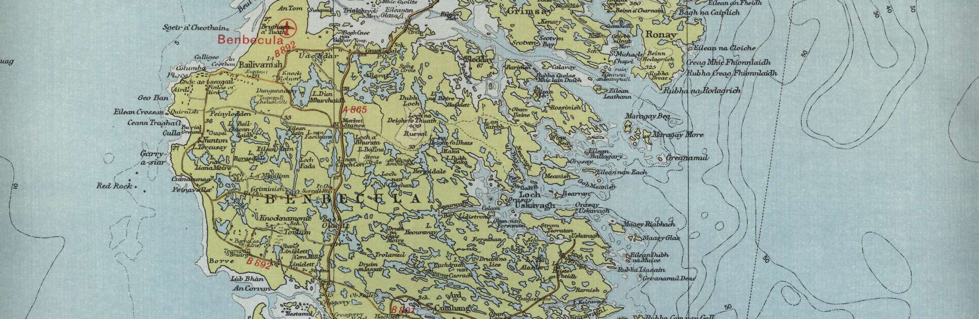
Trout Fishing Lochs on Benbecula
Benbecula in Gaelic is Beinn na Faoghla which means Mountain of the Ford. Benbecula is a stepping stone between North and South Uist, the islands now being connected by a series of causeways but crossing from Benbecula to the Uists would at one time have involved fording dangerous stretches of tidal sands. The South Uist Angling Club , in addition to its fishing on South Uist, also manages the fishing on many of the lochs on Benbecula, including North Olabhat, East Olabhat, West Olabhat, Langabhat. The fishing is at its best from June onwards. The club has boats on many of its lochs. Bank fishing permits are £10 per day or £50 per week. Boats can be provided from £10 per day.
Benbecula Trout Fishing Map
Tap or click on the map below to view full size image

The maps on this website, extracts from the “Half Inch” Bartholomew map series of the mid twentieth century, have been reproduced with the permission of Collins Bartholomew. Viewers should note that these maps date back several decades, to the mid twentieth century in fact. While much of the man-made details such as roads and buildings will have changed over the years, the character of the hills, lochs and rivers, and the trout inhabiting them, will have remained very much the same as they have always been, in the more remote regions at any rate! This website shows detailed maps of the major fishing locations. In addition, however, I would recommend that anglers planning a Scottish fishing or walking trip should be sure to equip themselves with a compass, the appropriate local Ordnance Survey map and a working knowledge of how to use them. The most useful of the O.S. maps for the fisherman is the Landranger series, scale 1:50,000. For Benbecula, see O.S. map number 22.