Trout Fishing Lochs near Achiltibuie in Scotland
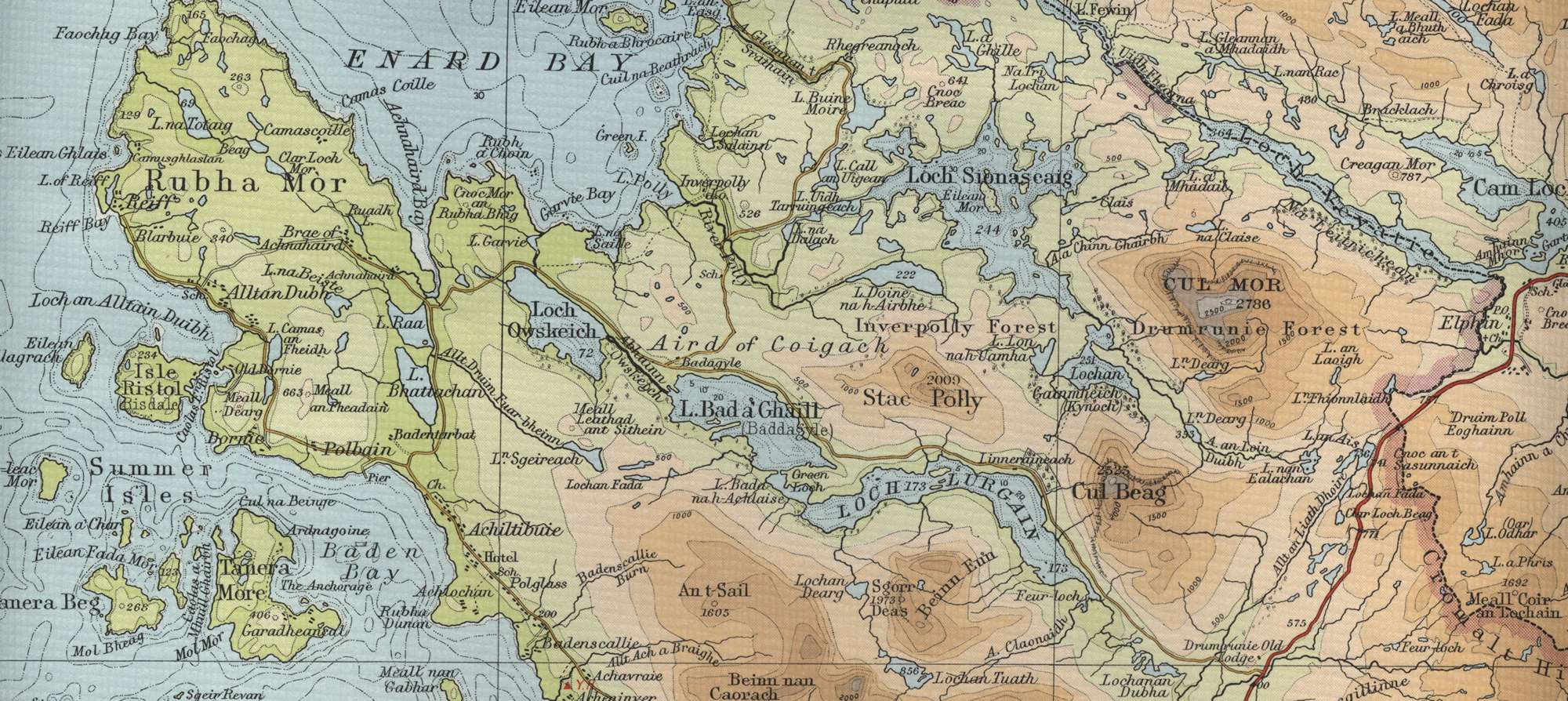
Achiltibuie is a small linear community, a crofting township on the western edge of the Coigach, looking out over the Summer Isles and the open sea to the west, with the mountains of Wester Ross rising behind to the east. It lies ten miles north of Ullapool and gives access to many fine trout fishing lochs, including Sionascaig to the north east and the smaller lochs of the Rubha Mor, such as Loch Raa, Loch Bhattachan, Loch Totaig and Loch na Beiste on the western side of the peninsula, all containing hard fighting wild brownies.

Enquiries should be directed to Coigach Craft Shop or Badentarbet Lodge, which also sell day tickets for the salmon and sea trout fishing on the River Garvie and Garvie Loch. The Coigach hill lochs will be found behind Achiltibuie. Anglers prepared to hike up the hill might be rewarded with a basket of modest sized brown trout. Enquire at the Summer Isles Hotel, Achiltibuie. Boats may also be booked at the hotel for sea trout fishing on loch Oscaig. Other lochs of note include Loch Lurgain, Loch Bad a Ghaill and Loch Owskeich (Oscaig) and Garvie, the latter having historic runs of sea trout, now sadly diminished since the coming of the salmon farms.
Achiltibuie Trout Fishing Map
Tap or click on the map below to view full size image

The maps on this website, extracts from the “Half Inch” Bartholomew map series of the mid twentieth century, have been reproduced with the permission of Collins Bartholomew. Viewers should note that these maps date back several decades, to the mid twentieth century in fact. While much of the man-made details such as roads and buildings will have changed over the years, the character of the hills, lochs and rivers, and the trout inhabiting them, will have remained very much the same as they have always been, in the more remote regions at any rate! This website shows detailed maps of the major fishing locations. In addition, however, I would recommend that anglers planning a Scottish fishing or walking trip should be sure to equip themselves with a compass, the appropriate local Ordnance Survey map and a working knowledge of how to use them. The most useful of the O.S. maps for the fisherman is the Landranger series, scale 1:50,000. For Achiltibuie, see O.S. map number 15.
For information on the salmon fishing rivers in the area see Salmon Fishing in Scotland