The Trout Fishing Lochs of North Uist
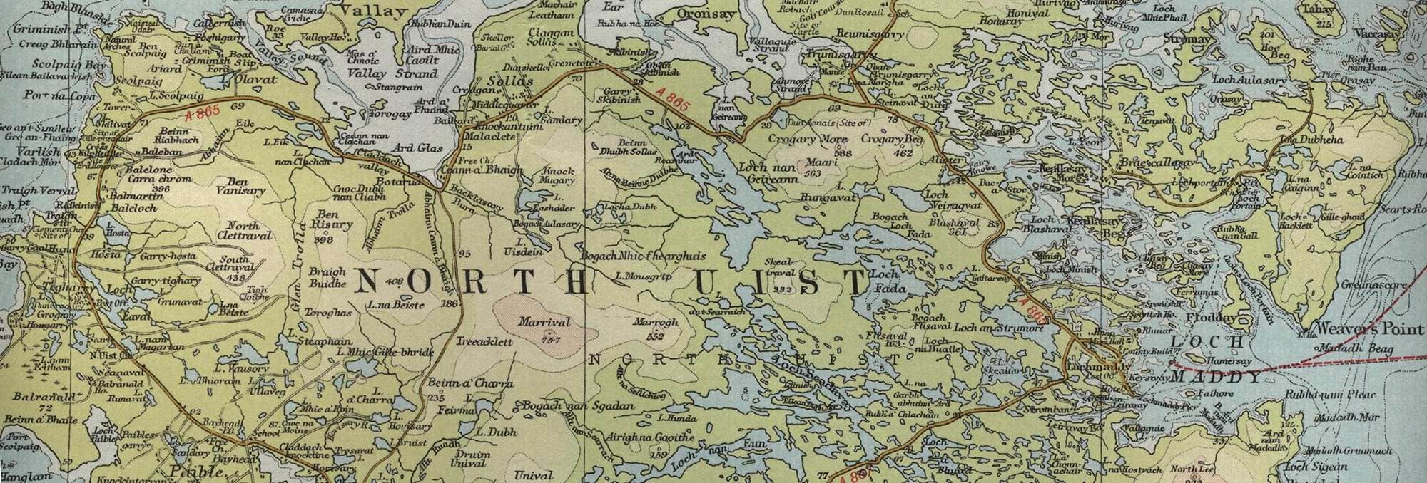
North Uist is one of the main islands in the chain of islands known as the Outer Hebrides or Western Isles whicch lie off the coast of north west Scotland. From the map below it would appear that there is probably as much water, fresh and salt, as there is land in North Uist, all of it offering the possibility of some excellent brown trout fishing, particularly on the famous Machair lochs on the western fringe, or wonderful sea trout fishing in the tidal sea pools. Much of the fishing is managed by the North Uist Estates, while the North Uist Angling Association makes many first class lochs available to the visiting angler. Lochs such as Olavat, Hosta, Grunavat, Fada, Scadavay, Huna, nan Eun, Vausory and Caravat are just a few of the many lochs to choose from.
North Uist Trout Fishing Map
Tap or click on the map below to view full size image

For the southern part of North Uist see Benbecula Trout Fishing
The maps on this website, extracts from the “Half Inch” Bartholomew map series of the mid twentieth century, have been reproduced with the permission of Collins Bartholomew. Viewers should note that these maps may date back several decades. While much of the man-made details such as roads and buildings will have changed over the years, the character of the hills, lochs and rivers, and the salmon and trout inhabiting them, will have remained very much the same as they have always been, in the more remote regions at any rate! This website shows detailed maps of the major fishing locations. In addition, however, I would recommend that anglers planning a Scottish fishing or walking trip should be sure to equip themselves with a compass, the appropriate local Ordnance Survey map and a working knowledge of how to use them. The most useful of the O.S. maps for the fisherman is the Landranger series, scale 1:50,000. For North Uist, see O. S. map numbers 18 and 22.