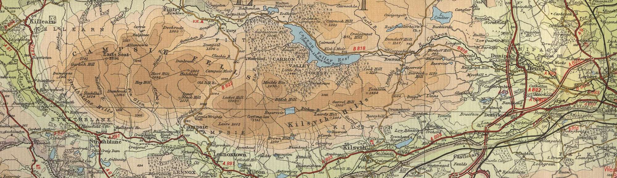
Trout Fishing Lochs near Carronbridge
Carronbridge is stuated on the river Carron a short distance from where the rivers leaves Carron Valley Reservoir, in the Campsie Fells midway between Stirling and Glasgow. To the trout fisherman, the major attraction here is Carron Valley Reservoir, offering boat and bank fishing for brown trout on this lovely loch, created by the flooding of the upper Carron valley in the nineteen thirties, in magnificent surroundings.

Other lochs worth a cast or two include, Loch Coulter (managed by Larbert & Stenhousemuir Angling Club), the Earlsburn lochs, Antermony Loch (Caurnie Angling Club), Walton Reservoir, North Third Reservoir, Birkenburn Reservoir (Johnny’s Dam) and Banton Loch (Kilsyth Fish Protection Association).
Carronbridge Trout Fishing Map
Tap or click on the map below to view full size image

The maps on this website, extracts from the “Half Inch” Bartholomew map series of the mid twentieth century, have been reproduced with the permission of Collins Bartholomew. Viewers should note that these maps date back several decades, to the mid twentieth century in fact. While much of the man-made details such as roads and buildings will have changed over the years, the character of the hills, lochs and rivers, and the trout inhabiting them, will have remained very much the same as they have always been, in the more remote regions at any rate! This website shows detailed maps of the major fishing locations. In addition, however, I would recommend that anglers planning a Scottish fishing or walking trip should be sure to equip themselves with a compass, the appropriate local Ordnance Survey map and a working knowledge of how to use them. The most useful of the O.S. maps for the fisherman is the Landranger series, scale 1:50,000. For Carronbridge, see O.S. map number 57.